It’s a good thing we enjoy a good ham and cheese sandwich. On our recent trip to Argentina and Patagonia, we were amazed at the ubiquity of this tasty combination.
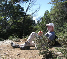 On our very first day in Buenos Aires, exhausted from jet lag and very hungry, we stopped at an empanada stand. Empanadas are a staple of Argentinian food. Basically, they are dough folded around a filling and baked. The name comes from the Spanish verb empanar, meaning to wrap or coat in bread. The available fillings were meat, onions and cheese, or ham and cheese. We opted for the latter. Delicious! OK, it was the first day, but we found a great lunch. Along the way, in other towns, we stopped in grocery stores, bakeries, etc. and ham and cheese was the filling we could consistently count on for empanadas.
As we traveled through the country, on most of our excursions, hikes, and sightseeing walks, a sack lunch was usually included. In the bags were an abundance of items—fruits, chips, salads, snacks and a ham and cheese sandwich.
Because of the size of the Country, it is often necessary to fly from one place to another. We flew on Aerolineas Argentinas, a nice domestic airline that goes everywhere. On each domestic flight, no matter the distance, we were served—you guessed it—a ham and cheese sandwich (with a sweet dessert).
So, we are walking along and exploring a town on our own, and decide to stop at a restaurant or cafe for lunch. Maybe just pick up a quick sandwich? Looking at the menu under sandwiches, there are several options: ham and cheese, ham, cheese, ham and cheese and egg, ham and cheese and tomato, ham and egg…well you get the picture. Substitute the word “Spam” for “ham” and you have a Monty Python routine.
Why so much ham? Much of the cuisine in Argentina comes from the Spanish and Italian immigrants, and hams were very popular in both countries.
Rolling through the countryside and looking at the farmland, we see lots of cows (explaining the cheese and the milk in the wonderful cafe con leche), sheep, horses and other animals, but the one animal that seems to be missing is a pig. I guess all the hams are out to lunch!
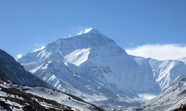
 On May 21, 2010, California Native owners Lee and Ellen Klein were guests of Mexico’s President Felipe Calderón at a luncheon he held in Mexico City at Los Pinos, Mexico’s official presidential residence.

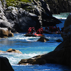 In the winter (our summer), when the snows fall, South Americans flock to the city to take advantage of the many winter sports. In the summer and fall (our winter and spring), people come to hike, raft, kayak, fish, enjoy lakeside beaches, and much more. On our recent scouting trip to Argentina, we sampled some of the abundance of activities Bariloche has to offer. We hiked beautiful mountain trails, stopping for lunch at overlooks above clear blue lakes while giant condors flew to and from their nests on adjacent peaks. We river-rafted down the scenic Rio Manso all the way to the Chilean border. And we enjoyed sumptuous meals of pasta, lamb and steak—to re-energize ourselves after all that exercise.
 Oh, did I mention chocolate? Bariloche is famous for it’s chocolate shops. Strolling from the quaint main square, with its wooden and stone alpine-look municipal buildings, down the main street, you are confronted on every block by at least two or three chocolate shops. We’re not talking about little shops—we are talking about big stores with cases and cases of chocolates by the pound, café sections for sampling decadent desserts, and aisles of every size box of chocolates you can imagine. Visit just before Easter as we did, and you can see some of the most beautifully decorated confections you can imagine. The store windows are like museums of chocolate. And, ALL of it is delicious! I know! I tasted! More than once!
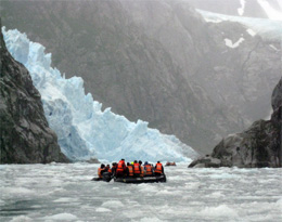 What is blue, white, frosty and cold? If you guessed a type of drink, try again! It is a glacier in Patagonia, and there are hundreds of them to see. The California Native scouting team was on our third trip to explore the area in March. This time we are developing a new itinerary for our adventures not only in Patagonia (Chile and Argentina) but also in other areas of the two countries.
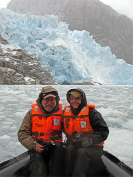 In the first of three weeks of travel in the region, we were able to set foot on Cape Horn (as far south as you can get without being in Antarctica), hiked an island in the Straits of Magellan, crunched our way up an ice field fjord in a zodiac, trekked in Torres del Paine National Park in the shadows of the snow-capped towers, visited the largest and the longest glaciers in Argentina, and even hiked up the glacier itself (crampons on!).
 Located on forty square miles on the east bank of the Ayeyarwady River, 300 miles north of Yangon (Rangoon),
 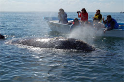 After a summer spent in the frigid waters of the Chukchi and Bering Seas, feasting on immense quantities of small crustaceans, the California Gray Whales begin their annual migration south to Mexico’s Baja California. Swimming 5000 miles along the North American coast, they arrive in the warm, protected bays to breed, give birth, and rear their infants.
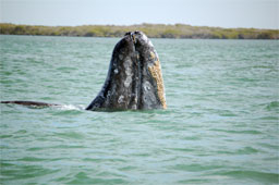
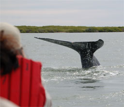 Easily accessible from La Paz and Loreto, Lopez Mateos and San Carlos are two coastal towns where pangas, small motor boats, depart for whale watching. Skimming along the water with frigate birds soaring overhead and whales breaching in every direction is an unforgettable experience.